Two Dutch Girls on a Road Trip to Wiltshire

Road Trip 2017 (2) - Richmond to Chawton to Salisbury.

Good afternoon! Would you like to join me for the second part of my road trip in the South-West of England? A long time wish of my daughter...

Showing posts with label #The Netherlands. Show all posts

Wednesday, 3 August 2016

The Hike 12 - Rhoonse Grienden

In preparation for my hike in The Peak District (soon, soon!!) my friend Jo and I took ourselves to a typical Delta landscape yesterday: the Rhoonse Grienden.


Not only the landscape was typically Wetlands Style, so was the weather... It rained continuously.
But never mind, we always tell ourselves we will not melt. 


The Rhoonse Grienden are a tidal landscape just off the River Oude Maas, in the South-Holland province of The Netherlands. In fact Rhoon is a suburb of Rotterdam these days, but it used to be a sleepy village on the Oude Maas, and when you hike there it is very easy to forget the humongeous city on its doorstep. We passed one dog walker and one cyclist.

The Rhoonse Grienden used to be a working landscape grown for its willow branches which were then made into lobster and eel pots and willow baskets. My great-grandfather was a willow basket weaver and dirt-poor, with 16 children who had no shoes on their feet and 16 underpants between them, according to my Mum. 
Nowadays it is put aside and conserved for "nature" and is very proud of the fact that it has 4 legitimate brown beavers living there. It were those beavers that Jo and I hoped to spot yesterday.

I have been on the lookout for beavers for thirty years in the few areas that claim them, but so far I have never seen one in the wild (mind you, I didn't see one in Algonquin Park Canada either). Yesterday was no exception...alas. But I did find a beaver castle! Can you make it out?


It was low tide, so lots of mud, which made it easy to spot all kinds of tracks.


As you can see us Dutch hikers are not daunted by a spot of rain. Which is a good thing, since my favorite weather woman Helga van Leur posted new statistics proving that climate change will get us even more rain in the years to come.

The Rhoonse Grienden have several hikes mapped out; the longest will take approx. 2 hours. They are very easy to follow, simply walk from number to number and follow the red arrows. We did a 1 hour one.


Mind you, when you are allergic to the color green, give this one a miss!


Will you just look at this willow (and me)! Isn't it smashing? Who needs Greek olive trees? We've got beautiful characters right on our doorstep.

Right, the nitty-gritty:
Rhoon is to the South of Rotterdam, signposted, and to find the Grienden simply follow the signs saying Oude Maas. You can park your car right at the entrance (opposite a great restaurant/golf club called Abel).
We walked 8.012 steps which comes down to approx. 12 very wet km.
It rained, 19 degrees C, wind sw 32 km/h.
When you want a more classy expensive meal, Rhoon boasts a restaurant in a stately home called Het Kasteel van Rhoon.

Next post will be about my 6 days hike in the Peak District, so keep your eyes peeled!
Join me next time?

Sunday, 5 June 2016

Climate Change And The Wetlands

English folk claim to have a patent on moaning about the weather, but we Dutchies know a thing or two (or ten) about that subject as well!
If you don't know: we live in a Delta. Our country is criss-crossed by huge rivers, streaming down on us from France/Belgium and Austria/Zwitserland/Germany.


Most of the time those rivers are placid, simply flowing on towards the sea. But when it starts raining in those neighbouring countries, and starts raining heavily, we get a wave of river water streaming into our low-lying country that poses a threat.

Now, in the olden days, our ancestors knew enough to let those rivers flow over into water meadows. Sure, they let their cows and sheep graze there, but there usually was enough time to gather those animals onto higher ground. They even made earthen hillocks (called 'terpen') especially for those times even the water meadows couldn't hold all the surplus water and would build their farmsteads there. Smart people.

But nowadays our wetlands are overcrowded and our country is built up with endless suburbs and water meadows are deemed good overflow building land instead of overflow river water land. Not so smart...Our water engineers have been warning for years, decades even, but the local planning authorities seem to have a blind spot and suffer from sudden deafness when it comes to the warnings. Money speaks louder than words.

And thus we have a problem.
This week, due to the combination of a very high ground water level (the rivers) and extremely heavy rain, some parts of Brabant (a Southern province) had to deal with water rising more than 2.5 m above normal levels, and basements and parking garages and some neighbourhoods were flooded.

And suddenly the newspapers are full of the CC words. Climate Change is here! It's not around the corner, in the future somewhere, nope, it has arrived with its suitcases packed full of wet stuff and it has planted them firmly in our living room. Hi honey, I'm home!

Of course, us being hardy no-nonsense wetlanders, used to a bit of water, they immediately gave us some good news as well. Yes, more rain, more clouds, more mist, more storms, but also some goodies we have all been pining for: we will get more exotics as well. And higher temperatures. In fact, De Volkskrant newspaper told me that our climate has shifted up as far as Paris already. We have Parisian weather - oh la la, how chique! And in a couple of years we will have shifted as far South as Lyon, saving a huge portion of us a shitload of money and a lot of driving hours as we won't have to migrate to the Ardeche in Summer any longer.
Mind you, we will need that money we will have saved for buying mosquito repellant as the tiger mosquito is invading (able of carrying Zika virus, amongst other viruses) surfing on those higher temperatures. And oh horror, will the snakes come slithering in as well? Probably.

Today, our climate showed its sunny side. For the first time in weeks we had a completely dry day and could enjoy the outdoors without a wintercoat on. It was wonderful. I sang a chanson to celebrate.


Oh well. I'll invest in some good wellies and make certain I'll have the sandbags ready. Just in case.


Thursday, 25 February 2016

The Hike - 4

Our national emblem should be the willow - not that silly lion...as if we have lions roaming our lands.
On my fourth hike towards The Hike in Northumberland, I passed many, many willows, by far the most common tree in my area. But this one, an ash, caught my eye, as it is symbolic for my wetlands delta, valiantly hanging on even when knee-deep in water.


Today was a perfect day for hiking: wind wsw 18 km/hr,2 degrees C, humidity 83%,the occasional hail shower, but mostly sunny. Well, not counting the dramatic clouds.
I set off from home and decided to get the polder stretch out of the way first, ending along the Haringvliet water with the wind at my back (see photo above).


Walking through the polder has a dynamic of its own. It's mostly battling with the wind and hoping you won't get crashed into from behind, as most polder dwellers drive like maniacs and expect you to jump into the verge.

This is typically wetlands scenery. A sloot, a straight stretch of narrow road and an endless sky.


From this distance you can really see how our local church tower and ship are divided.


Although it hailed occasionally, the bulbs along the road showed that Spring is definitely on its way! I'm a sucker for spring bulbs,  they give such a feeling of hope, that sure, sunshine will be part of our days again.


Whilst I am typing this it is hailing most fiercely, so I took my walk at the right time!
Along the way, on the Westdijk, I passed this vegetable plot, artistically draped along the dyke.


Due to the mild winter there were quite a few cabbages and sprouts still looking good.
After the Westdijk I passed from polder into dune landscape, as I was nearing the Haringvliet, the sea arm that divides my island of Voorne from the next island of Goeree-Overflakkee. The soil turns from heavy,greasy clay straight to sand and the trees change accordingly from willows and such to thorny shrub, ash and birch.


This path leads you from the last tarmac road through the dunes to the Haringvliet.


Look at that. You have your mangroves in Florida, we have our solitary ash in the wetlands. This sea arm, due to its being cut off from the sea since the Seventies and being fed by three huge rivers is sweet water, but no one has told the shells, so they are saltwater shells still, mixed with some fresh water ones.
I used to scoff at this stretch of water, being spoiled by holidays abroad and the cold green blue waters near my first home in Hampshire (GB). But I've made my peace with the Haringvliet and quite like it nowadays.


This was the best part of the hike: up the dune and down the dune, with the gently lapping water always close by on my righthand side, the occasional gull overhead and thankfully no more hail.
It took me 2 hours to get home, and 28.640 steps. 
I'm already planning the next hike, which will probably take me over to the next island by bus and back on foot.
Join me?

Sunday, 14 February 2016

The Hike - 3

Preparing myself for my hiking holiday in the North of England is proving more difficult than I thought. Our wet Wetlands weather, fickle as it normally is, has been challenging to say the least.
But last Sunday turned out dry, so I jumped into my hiking shoes and set off for a hike around my neighbourhood of Nieuw-Helvoet, before the floodgates would open once again.


This vibrant Viburnum greets me every day, on my daily walkie-with-my-doggie, and isn't it gorgeous? 
It is a good example of the many Viburnums which are lovingly dotted around this neighbourhood. People in Nieuw-Helvoet are proud of their front gardens, on the whole (always exceptions).

I set off from home and turned left, taking the old through-road from Nieuw-Helvoet to the naval port of Hellevoetsluis. Nieuw-Helvoet is contrary to its name actually quite old, dating from 1367,and has a beautifully preserved traditional ring of houses (also called 'Ring') around the old church. 
But archeologists have dug up remains of habitation from the Iron Age (800 BC), along with clear evidence that the land was flooded again and again, which made living around these parts a challenge to say the least!
Churches in my part of the country were more often than not built in two parts: the ship and the bell tower separately. 


You can see from the shape of the tower that it has a square, no-nonsense shape, and that money was short. Hence bricked-in "windows" where, in more affluent places, a leaded glass window would be.Life on my island of Voorne was hard.


As you perhaps can spot,the year 1820 is on the plaque of this traditional house in the Ring. Which makes it one of the newer houses, paradoxically.
This one, the Raadhuis (town hall), dates from 1760.


Nieuw-Helvoet has long since been integrated into the larger town of Hellevoetsluis, but it has retained its tiny-town atmosphere. Nieuw-Helvoet was here first, and used the mooring place they called Hellevoetsluys as their harbour on the sea arm called Haringvliet, separating my island of Voorne from the next island of Goeree-Overflakkee. It was only when the Dutch government decided to make Hellevoetsluys their major naval port, that the number of its inhabitants exceeded that of Nieuw-Helvoet.
(If you are into names: Haring = herring, vliet = river, hence "the river where you can fish for herring". Helle = difficult, voet = foot, sluys = lock, hence "the place where there is a lock from the sea arm Haringvliet to the difficult navigable river Hellevoet")


I've told you before that the graveyard is on my route, and this time I decided to enter it so I can show you a traditional Wetlands burial ground. It is still in use, but only people from this neighbourhood can be buried here. It has one official Common Wealth War Grave, a bit forgotten now, and on the whole is rather quiet...Most of the old families, with their family graves, have been lost in history.

But look what I found...Mathilde Bernardine Washington, born July 11th 1888, Died May 1st 1989, wife to corn merchant and sometime mill keeper Hermen Maasdam. This tickled my curiosity!Was this an American bride, that for some reason had ended up in my wetlands? So what do you do then? Right, you consult Mr. Google.
And you find out that Mathilde was the daughter of Wilhelmus Wassinghton (note the spelling!), born December 1829 in the Northern province of Friesland, and his marriage issued "7 children born without life from 1860-1869" - so my, old Wilhelmus must have been chuffed to get a living Mathilde in the end!But what caused the spelling of her name on this gravestone? Was it a mistake? Google couldn't answer this question.


I'll end with the Viburnum I started with, simply because I adore the way this homeowner lovingly trims his box.
My hike was a short one, only 5.913 steps, but the weather was great for a change and I enjoyed it. Hope you did too!
Join me next time?


Sunday, 24 January 2016

The Hike - 1

Well-aware of the beneficial influence of hiking on the psyche, I have booked myself a hiking holiday in Northumberland in August, where I am supposed to be able to do 6 hour walks up and down those hills.
Being gruesomely out of shape, a hiking training program seems in order. Want to accompany me?


If you are following my blog, you'll know that I've had a rather bumpy ride of late...No need to go into it, but I really need some changes in my life and mostly in the mental department. And since mental and physical are closely intertwined, I have devised a training schedule for myself with the aim of getting me able to walk those Northern English hills without pain and without embarrassing myself.

So, today was the first day of the new and better me (loud guffaw inserted here!).
I set off from my new home on the outskirts of my suburb of Nieuw-Helvoet, and set myself a hike of 1 hour brisk walking.The weather conditions could have been better, but definitely a lot worse. It was dry, but foggy and damp (humidity 100%: quite normal for my part of the Dutch Wetland Delta) and very gloomy, with a light south-south-westerly wind of 16 km/hr and a temperature of 4C.

I decided to walk towards the old hill fort in Nieuwenhoorn.


I pass this when I cycle to work, and like it very much.It is part of the old naval defense works, but is in disrepair. Farmers are allowed to graze their sheep around it, and the sheep are accustomed to stand in the middle of the cycle path looking blank.


After passing the hill fort I came to the village of Nieuwenhoorn (now part of my naval town of Hellevoetsluis)and turned right. This wind mill, called Zeezicht (Why? You cannot, and was never able to, see the sea from here!)has been an eyesore for years as it was practically falling apart. But thankfully now it is being repaired. 

Walking along the main road into Hellevoetsluis, I came across this placard.


This needs some explanation as to why it made me laugh out loud. 
Here we go; a quick lecture on the Dutch psyche.
We are a nation of ice skaters. You think the Canadians have the honour, but you are wrong. We Dutchies have invented ice skating, and it is in our blood. The placard reads "Sharpening Skates" and it is a manifestation of wishful thinking. For we hardly have any frosts anymore, and if we do have them (like this past week in fact), the temperatures don't drop below zero far enough to get us ice thick enough to skate on. This hurts. It makes us migrate to parts of The Netherlands where they do have ice thick enough (the North-East, where the mild sea winds don't reach)or even to Austria to skate our largest skating event on the Weisensee and pretend we are in Friesland.


This Blue Heron at the end of my street is the better for it - they suffer when there is ice. It watched me walk past and cheered me on. They are quite common in my part of the country (I remember English twitchers going wild with envy when I told them I see them every day in my country)and pretty tame. Still, naive bird feeding people do get an eye pecked out by herons from time to time...

And that concludes our first hike. I hope you've enjoyed walking along with me and will join me next time.


Thursday, 22 October 2015

The Oostvoornse Duinen - Wetlands Supreme!

For those of you who enjoy hiking (but walking is fine as well), I have a tip for you that will give you entrance to one of the oldest and most varied dune landscapes of The Netherlands:
The "Oostvoornse Duinen".


The Sea Dunes

It being our Autumn break, I went there yesterday with my regular hiking companion, who used to be 2, 3, 4...and is now 22 years old.


My son and I enjoy walking together, and this part of our island of Voorne is our favourite.
It was a typical Wetlands day: misty, damp, grey cloud cover and threatening to rain (and sure enough half-way through it did start to rain and wouldn't stop).

Oostvoorne is a small town, part of the larger municipality of Westvoorne (comprising of  Rockanje, Tinte, Brielle and Oostvoorne). To get there you take the largest motorway (which thankfully still is a two-lane) N218 and then follow the signposts to the starting point of our hike: the carpark next to the Natuurmonumenten/Zuid-Hollands Landschap Education Centre ("Bezoekerscentrum") on the Duinstraat 12a. (Adjacent to the comfortable restaurant called De Meidoorn).

Bezoekerscentrum 


The landscape has slowly evolved over the centuries. It used to be mostly sand dunes, but due to landowners planting tree plantations and acid rain it is now a very green area with lots of trees, shrubs, berry carrying shrubs and grasses and reed beds  as well as sand dunes. In order to keep the grasses in check, large areas have been fenced in (this IS The Netherlands after all) so that herds of sheep, ponies and cows can graze there in relative freedom.


Contrary to what you might think, the bottom line doesn't mean that there is no danger of meeting a wolf, but that you have to keep your dog on a leash. We don't have wolves (yet) in this part of the Wetlands.


My son and I decided to take one of the longer walks; the walk around a dune lake called Het Breede Water. (2 hours)
To get there, you have to take the path to the right next to the education centre and along the attractive lake called the Tenella Plas. Again, this being the Netherlands, there is no danger of getting lost: the paths are mostly signposted by means of coloured arrows. The Breede Water route is clockwise, signposted with a white arrow.

Tenella Plas

Tenella Plas


At first there are still some small farm houses dotted around (much sought-after to live in these days), and the typical meadows that belong to them.


Actual farming is forbidden now though, the landscape has all been given back to 'nature' (which is a laugh, really. It is as well tended as a garden!)

As soon as you have crossed the horse bridlepath, you enter a wet area, so wellingtons are a good option from October onwards. In fact, if we have a wet winter and we usually do, many of the paths are extremely muddy.

You now walk along a sandy/grassy path adjacent to one of the old pine plantations (on your left). To your right are the older dunes, with many berry carrying shrubs which attract numerous birds.


As a girl I always laughed to see the sparrows and blackbirds get drunk on the orange berries of the meidoorn.

After approximately half an hour you can view the largest dune lake, the Breede Water, on your right hand side. There is a viewpoint ("Uitzichtpunt"), from where you can spot the waterfowl whilst they cannot spot you.

Breede Water

Cormorant's Island

In Spring the Breede Water is an overcrowded place, with cormorants, swans, ducks, geese, herons (both white and blue) and spoonbills making their nests there.
Yesterday is was deserted.
I used to take my son's friends around the lake as a birthday treat (picknick), and since his birthday is in April, those boys always walked demonstratively with their noses pinched because of the stench of Cormorant's Island.

This area has so many happy memories for me! I came here with my Mum (and dogs), and then with my kids (and dogs).


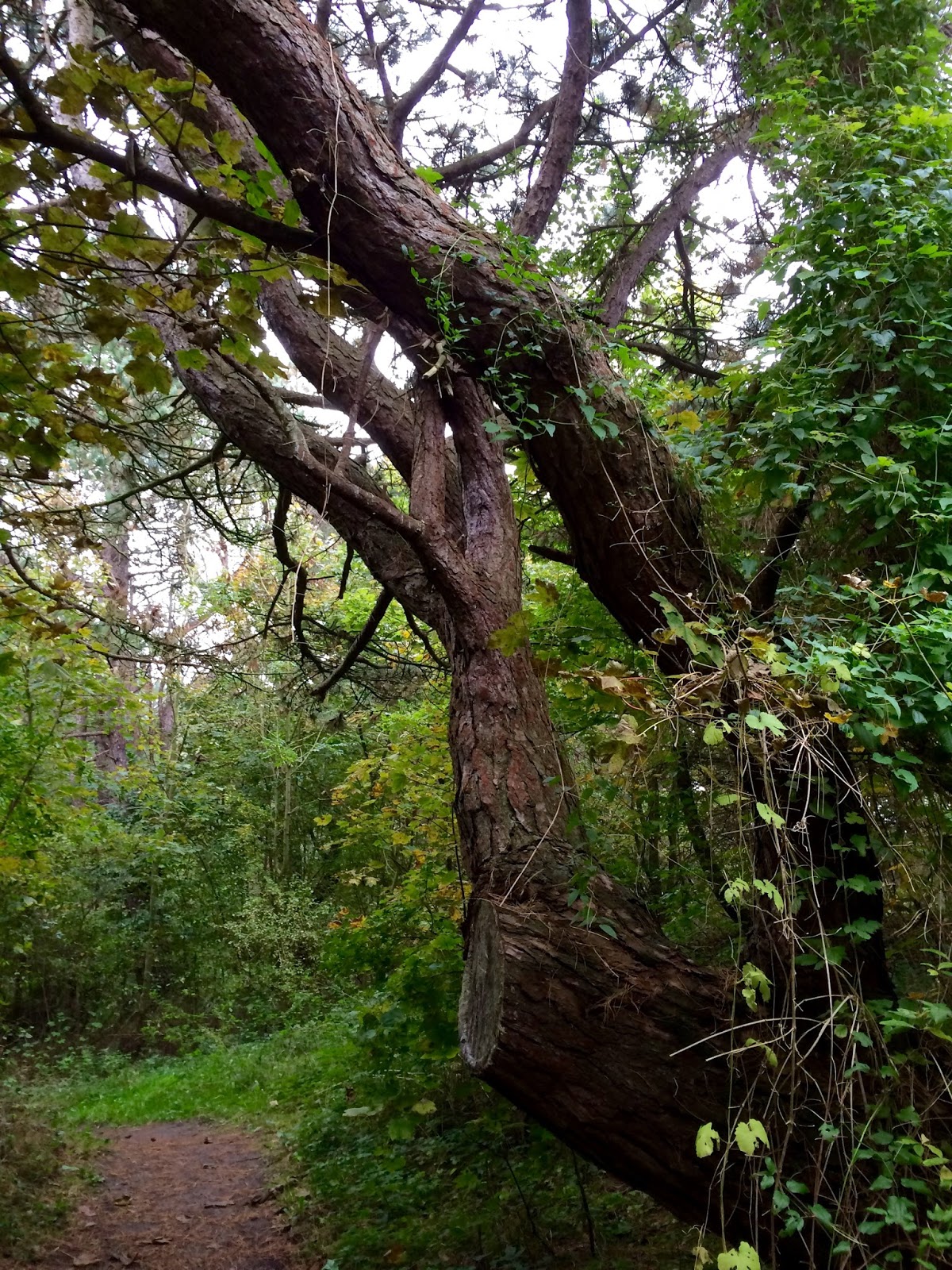
To my dismay the favorite climbing tree of my children has been chopped...


Just look at this... This was 12 years ago.
As I said, you walk around the Breede Water clockwise, so at the half-way mark you enter the proper dunes.


This is the closest thing we Wetlanders have to anything slightly resembling a hill (tiny), and it used to be all SAND when I was a girl!


Breede Water from the other side, black pines in the background

I hope you will be able to follow those white arrows, for this is the (only) point where the path is a bit tricky (hard to see), and you could get lost.
Still, you are always in sight and reach of your GPS satellite, so don't you fret!

When you have almost reached the point where you started walking around the Breede Water, you again enter the forest.


The Beeches are just starting to turn


You'll know when you have not strayed when you again reach the Tenella Plas.
Do go and visit restaurant De Meidoorn before you start you car! They do lovely Dutch grub and the ambience is very friendly.

I hope you have enjoyed this route. Whenever you are near - come visit Voorne!

Google Maps pointer: type in Tenellaplas Oostvoorne.